How to use height of instrument method to find out the R.L. or reduced level of various points

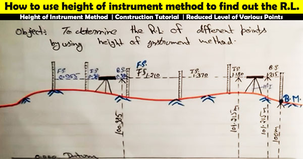
In this construction video tutorial, one can learn how to find out the Reduced Level or R.L of various points with the help of height of instrument method.
The levels on the site plan belong to the numbers adjacent to the crosses on the site plan. The cross marks where the level was captured on the site with the equipment, and the number refers to the height.
The heights where these 'levels' are positioned are defined as the Reduced Level (or R.L for short).
The R.L is documented in 2 ways like an arbitrary number, or, in accordance with the Australian Height Datum (AHD).
Reduced Level in surveying stands for the equating elevations of survey points relating to a common assumed datum. It is a vertical distance among survey point and selected datum plane. Therefore, it is treated as the base elevation that is employed as reference to guess heights or depths of other crucial places. Here, Reduced signifies equating and Level signifies Elevations.
In any specific arrangement of an instrument height of instrument, that is the elevation of the line of sight, is invariable. The elevation of unknown points is acquired by deducting the staff readings at the preferred points from the height of instrument. This is the fundamental concept behind the height of instrument method for reduction of level.
To find out the detailed calculation process online,
watch the following video tutorial.
Video Courtesy : CIVIL CREATER

